Yao, C., Fabritius, H., Fricker, P., & Dembski, F. (2024). Research Note: Multi-Algorithm-Based urban tree information extraction and Its applications in urban planning. Landscape and Urban Planning, 253, 105226. https://doi.org/10.1016/j.landurbplan.2024.105226
Supervisor: pia.fricker@aalto.fi
For more information please contact: chaowen.yao@aalto.fi
2021 – 2022
Multi-Algorithm-Based Large Scale Urban Tree Information Extraction and Its Applications in Urban Planning
Abstract
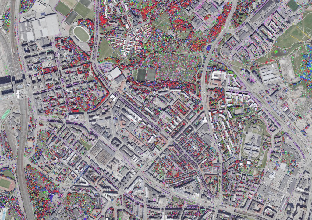
Urban trees provide several vital social and environmental services. Within the field of urban planning, tree information is currently usually obtained through expensive and time-consuming fieldwork. This research presents a multi-algorithm methodology that extracts urban tree information, including tree location, absolute height, crown perimeter, and species (group) from airborne laser scanning (ALS) datasets and high-resolution aerial images. We first determine the location of trees from the ALS dataset. After a filtration step removing the erroneous tree locations, we simulate each location’s canopy based on aerial imagery. Finally, we utilize the extracted canopy images to perform tree species classification with deep learning. The validation assessment showed overall good credibility (>70%) in urban areas and better performance (90%) in street areas. Compared to other methods that require additional information collection, our methodology uses common data in city databases, enabling cities to collect and update large-scale tree information in a fast manner and supporting decision-makers with important information on understanding the value of urban green under the context of ecosystem services, urban heat islands, and CO2 mitigations.
Aim
The overarching goal of this study is to discuss the combination of individual computational tools into one multi-algorithm methodology, enabling the extraction of individual urban tree information through a novel integration of existing databases and tools within 4 distinguished steps. By achieving rapid and systematic access to such valuable urban tree information, this approach holds significant potential for a wide range of applications.
Method
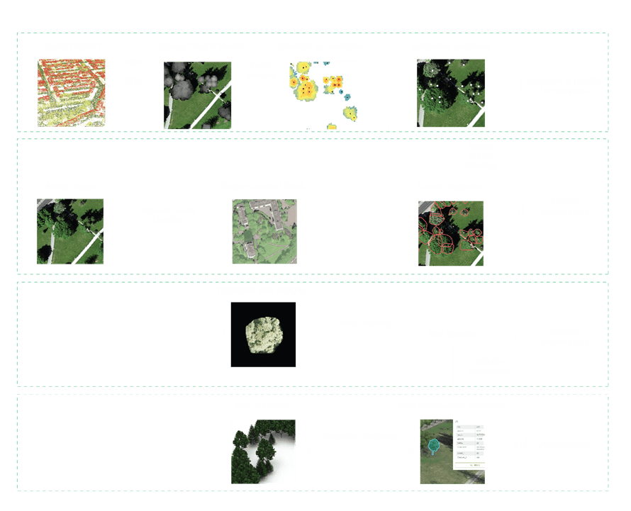
The workflow used to extract multiple information of trees from the ALS data and imagery datasets. In this study, the Lidar dataset first outputs the canopy height model (CHM), used to generate treetops with height information. The aerial image processed by maximum likelihood classification is involved in this step to filter out the misclassified treetops. Based on the detected treetops, high-resolution imagery is utilized to identify the crown for each tree. The tree crowns define the scope for deep learning used to classify the tree species (group). Finally, results with corresponding inventory data are assessed and output integrated as an information database.
Validation
Overall, the algorithms are qualified to effectively extracted various tree information from urban areas, especially having a high confidence in areas such as streets (see original paper). A total of 562 out of 767 trees (0.73) in validation areas are extracted with fully accurate locations and species via comparing with the inventory data, and another 151 trees (0.2) are successfully extracted with either correct location or species information. It should be emphasized that in order to ensure generalizability, the research not just selects tree species with distinct characteristics differentiation for identification. For instance, a major factor of error within the site is the confusion of Acer with other tree species. If all the identified Acer tree species in the validation area are ignored, the accuracy of other tree species in the area reached 0.83. It is noteworthy that coniferous species with regular and distinctive canopy volumes are more easily collected than deciduous trees with large canopy volumes.
Discussion
For most cities, large-scale UAV imagery as well as terrestrial LiDAR collection is an expensive option. Compared to other studies which require additional information acquisition, our method uses common data available in cities as input data, allowing for low-cost information extraction while maintaining a good level of confidence. In our paper, for example, ALS, orthophoto, and tree inventory are all available to public in Helsinki Map Service, and no manual data collection is conducted for the experiment.
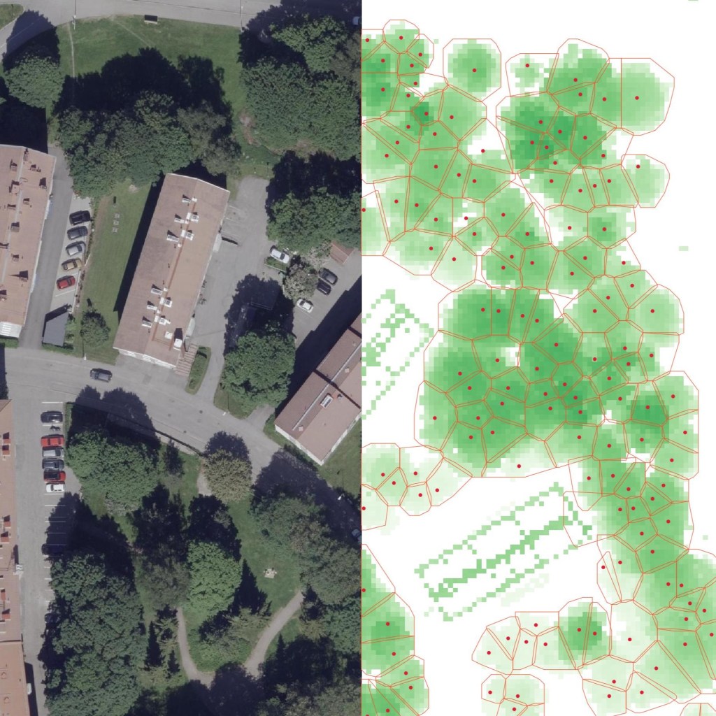
Figure 3. Comparison between orthophoto, information model, and 3D model.
