For more detailed information please contact: chaowen.yao@aalto.fi
Supervised by Dr. Prof. Pia Fricker at Aalto university
2022 – Present
From Data to Decarbonization
Novel Simulation Plugins for Urban Decarbonization Design under Digital Twins
Introduction
Achieving climate neutrality is essential for cities worldwide, addressing not only environmental challenges but also improving the well-being of urban populations. Urban forest, a cornerstone of urban development, offers critical climate benefits. From mitigating extreme heat to enhancing biodiversity and urban resilience, forests and green infrastructure are essential in creating livable cities. However, the effectiveness of such efforts in climate resilience requires a rigorous, data-driven assessment.
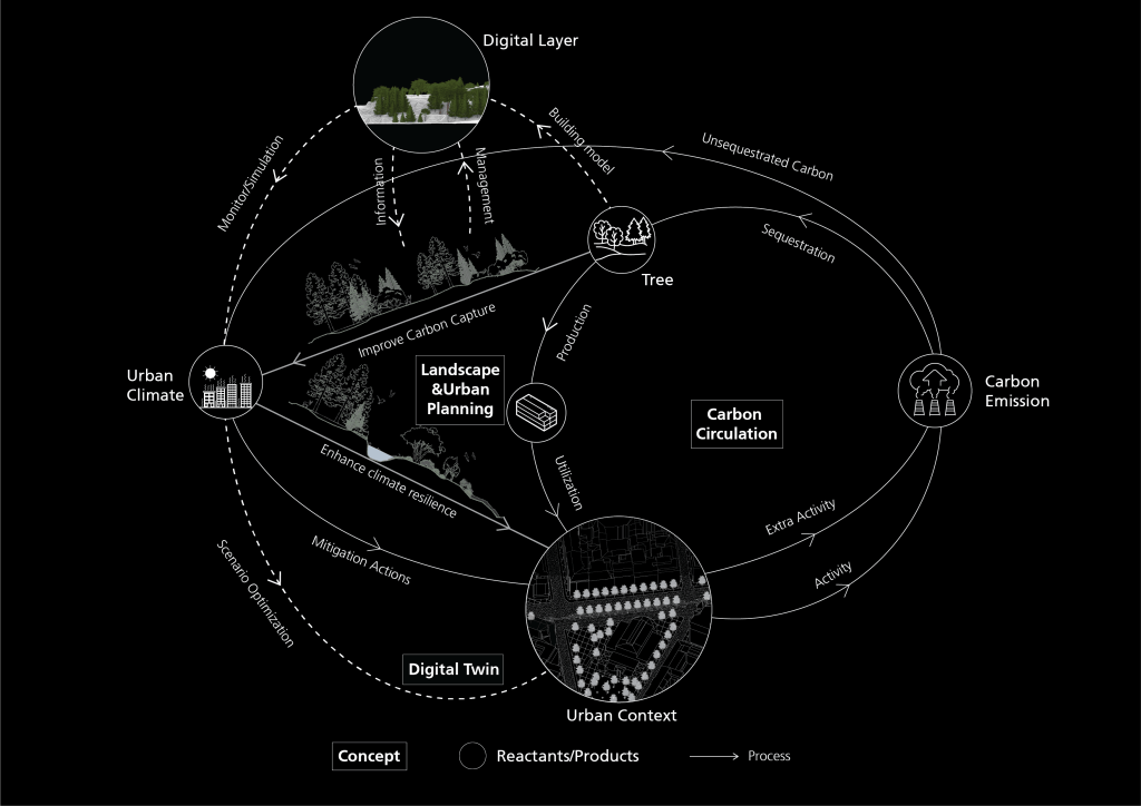
Advanced technologies, such as Urban Digital Twins, are emerging as pivotal tools in addressing urban climate challenges systematically. Yet, their potential remains underexplored, particularly regarding urban forestry. Current limitations include not only the fragmented data ecosystems hinder standardized workflows, but current estimates of urban forest carbon performance remain obscured by simplistic models that treat trees as static objects, failing to account for the complex inhibitory effects of the urban matrix. Standard Digital Twins often overlook the biological reality that a tree’s capacity to sequester carbon is heavily constrained by its immediate environment.
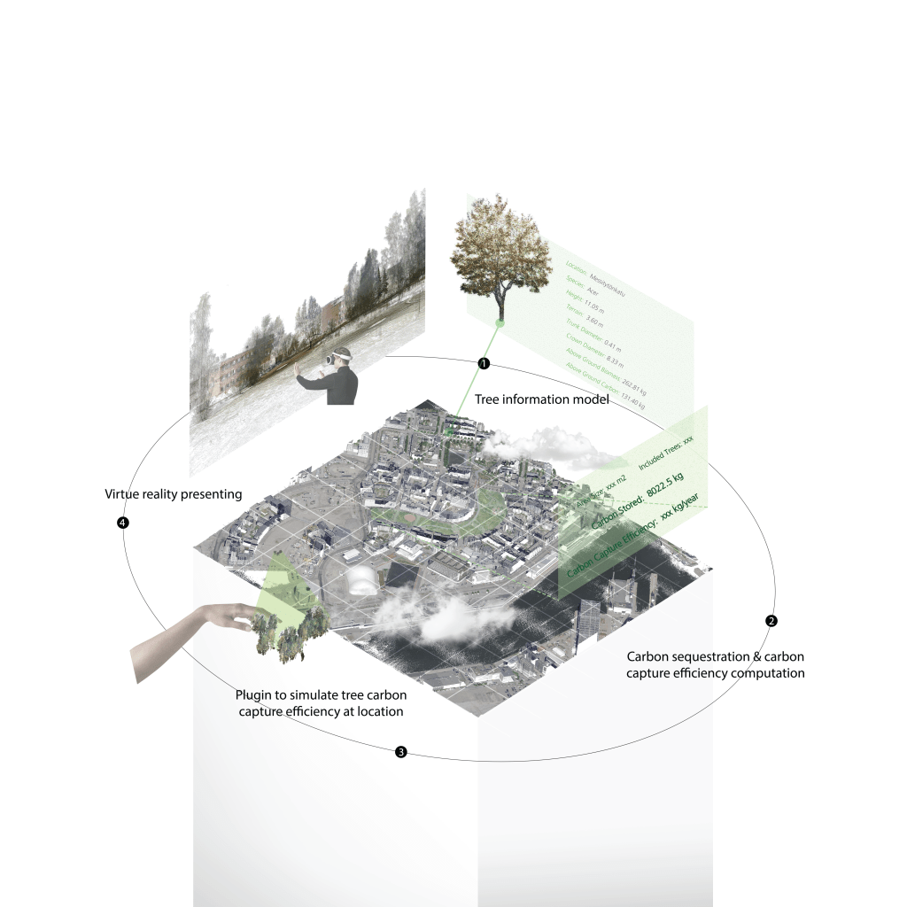
This research bridges this gap by developing a plugin that embeds detailed, stress-aware urban forestry data into Digital Twins. Building on my findings that urban morphology acts as a deterministic constraint on tree growth—explaining between 19% and 48% of carbon variance depending on the species—this project leverages multi-source LiDAR and machine learning to create simulation tools. These tools will allow policymakers to visualize the “invisible” carbon balance and optimize urban planning for maximum biological efficiency
Aim
The primary aim is to develop a computational simulation plugin that transforms static urban data into dynamic climate action tools. The project delivers two key outcomes:
A “Stress-Aware” Digital Green Layer: A high-fidelity data layer for the Urban Digital Twin that visualizes not just tree location, but species-specific carbon performance and environmental stress penalties (e.g., heat, noise).
Generative Simulation Plugins: A suite of tools for platforms like Rhino and GIS that enable planners to simulate the long-term carbon capture efficiency of different design scenarios before implementation, shifting practice from aesthetic planting to performance-based zoning.